|
|
|
What is Karelia?
Text and map by Andrew Andersen
|
When
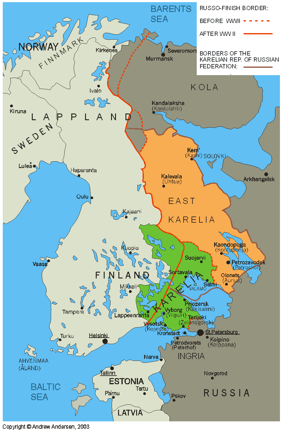
a Finn and a Russian say “Karelia” they often mean two different areas.
Finns
call Karelia (Karjala)
the green-colored area on the below map, the one that has been under strong
Swedish influence since 1200 -1300. It was part of Swedish-Finnish
Kingdom from 1323/1617 to 1721/1743,
part of the Grand Duchy of Finland between 1809 and 1918 and part of
independent Finland
in 1918-1939 and 1941-1944. As a result of World War II, most of what the Finns
define as Karelia was incorporated into the USSR
to become parts of Leningrad province and
semi-autonomous “Karelian Republic” its population been withdrawn to Finland. As of
today, the area still remains in Russian Federation.
When
Russians say “Karelia” they usually mean the “Republic
of Karelia” which is one of the
subjects of Russian Federation
(click here to see the map and political structure of Russian Federation).
Most of this territory was traditionally under Russian influence: first being
part of Novgorod trade empire
and after the incorporation of Novgorod
into Russian Czardom it ended being one of Russian
provinces. In Finland, this
area (on the below map it is orange-colored) is referred to as “East Karelia” (Itä-Karjala).
During
the 20th century, East Karelia lost
most of its indigenous population and was settled by ethnic Russians,
Byelorussians and other Russian-speakers.
BACK