|
|
|
Armeno-Georgian
War of 1918 and Armeno-Georgian Territorial
Issue in the 20th Century By Andrew Andersen and Georg Egge
|
|
|||||||||||||||||||||||||||||||||||||||||||||||||||||||||||||||||||||||||||||||||||||||||||||||||||||||
|
|
Ethnic
Composition of the Disputed Territories Armenia in turn considered the two disputed
counties Armenian basing on their ethnic characteristics. Indeed, by the
beginning of the 20th century, Armenians formed the majority in
both counties while their Georgian population was reduced to a tiny minority.
According the Russian census of 1897, the
ethnic makeup of the two disputed counties looked as follows:
Table 1: Ethnic makeup of the counties of Borchalo and Akhalkalaki
(Source: Russian Imperial Census, as of February 9, 1897.) Although Armenians as follows from the
above table formed a little bit less than one-third of the whole population
of Borchalo, they were the largest ethnic group of
the county as a whole Meanwhile, in its southernmost sector of Lori[2],
absolute majority of the population was Armenian. The non-Armenian minorities
Lori were presented by Russian sectarian colonists (Molokans)
who inhabited a few villages in the western part of the sector and Greeks who
resided predominantly in the town of Alaverdi and
around it. Tthe northern part of Borchalo, in turn, was much more ethnically diverse:
besides Armenians, Russians and Greeks, its ethnic palette included
significant amount of Tatars as well as German and Georgian communities. The below table illustrates ethnic
composition of the four sectors of Borchalo county
, as of the end of the 19th century:
Table 2: Ethnic makeup of the sectors of Borchalo county (Source: Family Lists of the province of
Tiflis, 1887) Historically, both Armenians and Georgians
inhabited the territory of Borchalo county at least
since the early Middle Ages. The above statement can be confirmed by the
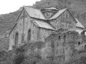
architectural and cultural heritage. In particular, the architectural
heritage of historical province of Lore (the sector of Lori) demonstrates the
traces of both Armenian and Georgian styles of mediaeval architecture
illustrated by Armenian monasteries of Odzun, Sanain and Akhlat as well as
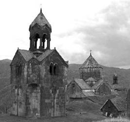
Georgian churches in Akhtala and Aqori. At the same time, the northern parts of the former
Borchalo county are clearly marked with the
prevailing Georgian elements the examples of which include but are not
limited to one of the oldest among existing Georgian churches – that is Bolnisi Zion erected in the 5th century and
still bearing authentic scripts.
Four centuries of almost permanent warfare
that preceded the absorption of Georgia by Russian Empire, resulted in the
drastic changes in ethnic composition of the south-western frontier of the
kingdom of Kartlo-Kakheti including historical
provinces of Borchalo, Shamshadin
and Pambak (After incorporation into Russia, Shamshadin and Pambak were
re-organized into the county of Kazakah of the
province of Elisavetpol and the county of Alexandropol of the province of Erivan). The expansion of
regional Muslim powers Ottoman Turkey and Iran, in combination with regular
raids of nomads, resulted in almost total annihilation or exodus of local
Christian population that had predominantly consisted of Georgian and
Armenian farmers. Later, depopulated Borchalo-Pambak
area was settled by Turkic-speaking nomadic tribes whose descendants still
reside there nowadays[3]. After the
annexation of Kartlo-Kakhetian kingdom bu Russia the imperial government launched the program of
colonising still partially depopulated Borchalo-Pambak
area with Christian refugees from Turkey (mostly Armenians but also Greeks)
In order to consolidate Russian dominance in this unstable area the government
of Russia also encouraged resettlement of farming communities from central
Russia and Germany into the county of Borchalo thus
making its ethnic palette even more complicated. As for the county of Akhalkalaki,
one can say that by the beginning of the 20th century its Armenian
majority formed over seventy per cent of total population. The proportion of
Georgians there was larger than in Borchalo but
still did hardly exceed six per cent. This ethno-linguistic situation was
created within much shorter period of time if compared with Borchalo. In the
province of Javakheti (later reorganized into the
county of Akhalkalaki) the drastic changes in
ethnic composition occurred within the last two thirds of the 19th
century when the province was conquered by Russia from Ottoman Turkey. Most
of the local Georgians who formed majority in Javakheti
as of 1827, just prior to the beginning of another Russo-Turkish war
(1828-29), have already been loyal Muslim subjects of the ottoman Empire for
several generations only few of them still adhering to Orthodox Christianity
or Roman Catholicism. Those Georgians who refused to convert from Orthodox
Christianity either to Islam or to Catholicism[4] during the period
of Turkish domination (1590-1827), were mostly forced to flee the province.
During the war of 1828-29, the Islamized Georgians of Javakheti
were actively resisting Russian invasion, and following Ottoman defeat most
of them left their native land to find refuge in Anatolia (central Turkey).
The victorious Russians almost immediately colonized the empty province with
the Turkish Armenians (mostly from the province of Erzurum) who were
encouraged by the Russian government to re-settle from the Ottoman lands to
the new Russian possessions in the Caucasus. One could add to the above that during the
First World War thousands of Armenian refugees from Turkish Anatolia (the
survivors of the ethnic cleansings of 1915-1918) arrived to the two disputed
counties many of them settling there permanently. The architectural heritage of the former
county of Akhalkalaki was also significantly
different from that of Borchalo. Here one can still
find a considerable amount Georgian architectural monuments going back to
both Early and High Middle Ages that include fortified monasteries of Vardzia and Zeda-Tmoghvi, the
churches in Azaveti, Poqa,
Qumurdo and many other famous landmarks. On the
other hand, most of the Armenian churches of the former Akhalkalaki
county are dated back to the period not earlier than the middle of the 19th
century
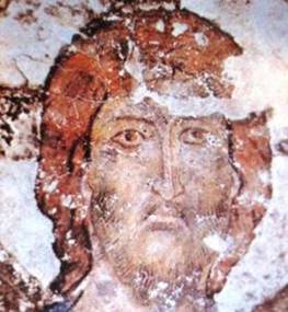
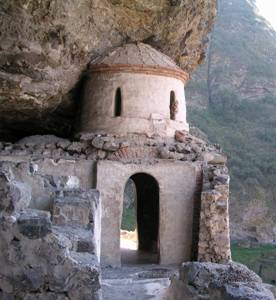
Fresco and chapel
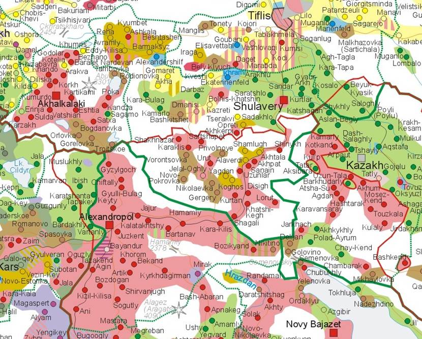
in mediaeval Vardzia monastery The below map shows the complicated ethnic
palette of the territories disputed between Armenia and Georgia as it was in
1913. The areas of Armenian majority is marked by pink and red colors while
lemon-yellow color goes for Georgian settlements, light brown – for Russian
colonies, yellow-gold color marks the areas of Greek colonization, light
green goes for the Tatar majority areas, grayish-green
goes for Anatolian Turks, light blue – for Germans settlements and lilac
denotes the areas of Kurdish concentration. The white color goes for
uninhabited or sparsely inhabited alpine and steppe territories.
|
|
||||||||||||||||||||||||||||||||||||||||||||||||||||||||||||||||||||||||||||||||||||||||||||||||||||||||
![]()
![]()
![]()