|
|
|
Armeno-Georgian
War of 1918 and Armeno-Georgian Territorial
Issue in the 20th Century By Andrew Andersen and Georg Egge
|
|
|
|
Restoration
of Armenian and Georgian Statehood On October 9, 1918, an independent Transcaucasian Federal Democratic Republic was proclaimed
in Tiflis (Tbilisi) facing the collapse of Russian Empire, revolutionary
anarchy and devastating Turkish invasion. The new state that virtually
embraced all South Caucasian possessions of the former Russian Empire (five
provinces and one territory to the south of Main Caucasus range), failed to
survive much longer than a month. Insurmountable contradictions between the
nationalist parties dominant in the government and parliament of Transcaucasian Federation that claimed to represent
incompatible interests of various ethnic groups of the region, led to total
collapse, and at the end of May 1918, the independence of the three new
republics: Georgian, Armenian and Azerbaijani, was proclaimed almost
simultaneously (at intervals of two days) in the same city of Tiflis. The fragmentation of federations into the
independent states is usually followed by the problems of territorial
demarcation. In this case, however, the situation evolved differently. The
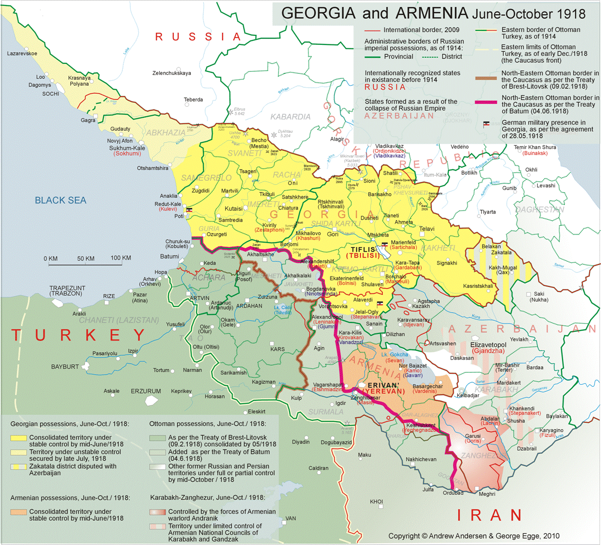
troops of Ottoman Turkey, whose leadership was planning to take over the
entire Caucasus, having overcome the weak resistance of Georgian and Armenian
units of the former Russian army, occupied a significant part of the region
and forced Armenia and Georgia to sign the Treaty of Batum
(June 4, 1918). Under the terms of that “peace treaty”, as well as several
subsequent agreements imposed by Turkey, the considerable part of the South
Caucasus was assigned to Turkey while the two newly formed republics were
curtailed to such an extent that they did not even share a common border. The
Armenian Republic was cut down to a tiny enclave around the cities of Yerevan
and Vagarshapat (Echmiadzin)
that included the county of New-Bayazet as well as
the eastern parts of Alexandropol,Yerevan,
Echmiadzin and Sharur-Daralaghez
counties of the province of Yerevan[1],
whereas Georgia that had entered into a separate agreement with Germany,
managed to keep the province of Kutais and most of
the province of Tiflis, excluding. The Ottoman-annexed counties of Akhalrtsikhe and Akhalkalaki[2]. Turkey was also given carte blanche to act
in Azerbaijan. As for the county of Alexandropol
lying between the truncated republics of Armenia and Georgia, it was
partially annexed by the Ottoman Empire in accordance with the Treaty of Batum. The remaining part of that county was also
occupied by the Turkish troops that were gradually penetrating into
Azerbaijan, the country that was just at the beginning of the process of its
territorial formation. (See Map 2).
Click on the map for better resolution Shortly after the Treaty of Batum was signed, the ottoman command insisted on a
"temporary transfer under Ottoman administration" of an additional
stripe of land in the Lori sector of the county of Borchalo
(Tiflis province). That part of Lori sector was lying close to the strategic
highway through which the Turkish troops were marching in a continuous stream
into Azerbaijan, where the armed struggle between Ottoman-protected Azerbaijan
Democratic Republic and the Bolsheviks that had seized power in parts of the
province of Baku was escalating. A segment of the said highway between Karaklis and Delijan was lying
in such a close proximity to the border of Georgian-controlled province of
Tiflis, that according to the Turkish commanders it was extremely important
to slightly move the border northwards in order to to secure the highway from
possible of some Armenian guerrillas that desided
to fight the Turks to the end. That “border adjustment”, however, was not
considered permanent, and the Turkish occupation of a small part of Lori
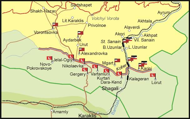
sector was initially intended to be of temporary character The following excerpt is from a Georgian
government document, published one year after the events described: “Meanwhile, on behalf of Turkey, got the Georgian
government a requirement to allow a
temporary derogation from the provisions of Article II of the Treaty of
June 4, 1918, and permit Turkish troops occupy temporarily a part of Borchalo county up to the river Kamenka
and the railway segment south of the bridge between the railway stations of Kober and Kalageran (117th
mile). This measure was necessary for
the Turkish command in view of the movement of their troops up the Karaklis-Delizhan-Kazakh road,
in order to ensure that maneuver to be performed
unhindered and safe. The demands of Turkish
commanders was supported by the representative of the German military mission
in Tiflis, and the government of Georgia had no other choice but to satisfy
the above demands and sacrifice their claims for the whole province of Tiflis
and the railway line to the middle of the tunnel behind the Shagali station. It had to agree to a temporal
de-facto possession by Turkey of the above territory. As a result of a number of military actions that have arisen in connection with
that demand as well as negotiations with the Turkish command, the Turkish
troops were given the right to take over the territory up until the line
along the right bank of Kamenka - namely: the
villages of Novo-Pokrovka, Jalal-Oglu,
Nikolaevka Gergery, Vartanlur, Kurtan, Dar-Kendo -
and further until the line starting from the bridge on the 117th mile of the Aleksandropol segment of the former Transcaucasian
railway lying at the midway between the stations and Kober
and Kalageran, and ending at the villages of Marts
and Lorut. The area north of this line was thus
secured from the Turkish occupation and in order to protect it from possible
Turkish invasion, it was occupied by Georgian military units being located
the villages of Vorontsovka, Alexandrovka,
Aidarbek, Mgart, the
railway station of Kober and the villages and Korinj and Tsater”[3]. By "a number of military
action" the author of the above quote most definitely means the
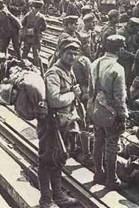
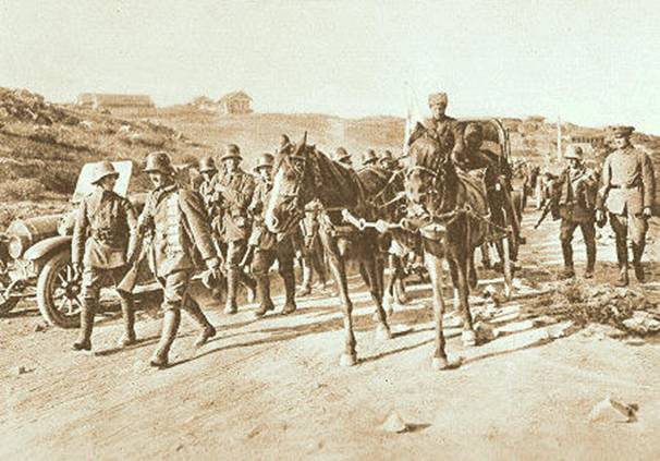
series of clashes that occurred in June 1918 between Georgian forces supported by
a few German units and Turkish troops that attempted in breach of the Treaty
of Batum, to continue their offensive from Karaklis in the direction of Tiflis. As a result of these
clashes Turks were stopped at the river Kamenka and
near the Red Bridge. The clashes led to a dramatic, albeit short-lived
conflict between the already weakening Central power allies: the German and
Ottoman empires. The demarcation line mentioned in the above-quoted document, became de-facto border of Georgia for the period between the signing of the treaty of Batumi and surrender the Ottoman Empire at the end of 1918. Thus, as we
already mentioned above, there was no common border between Armenia in Georgia up until the late autumn of 1918, as the stripe of territory lying to the south
of the demarcation line, was controlled by the Turks.
German and Georgian troops on their way to Kamenka
Figure 1: Dislocation of Turkish, Georgian and German troops along the
demarcation line (June-September, 1918.) Explanation:
|
|
|
![]()
![]()
![]()